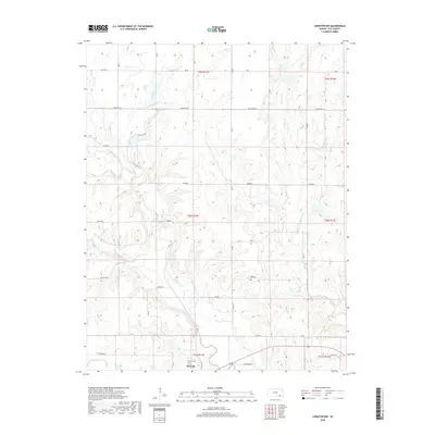
2018 Map of Longton NW
USGS Topo · Published 2018About this map
Elk Falls sits at the southern edge of this Elk County landscape, where the Elk River winds through a network of drainage creeks and rural sections. The settlement's proximity to the river is a defining characteristic of the local geography, with the Elk Falls Cem located just west of the town center. The surrounding terrain is marked by a grid of agricultural and access roads, including Junebug, Killdeer, and Grain Rd, which navigate the rises between several prominent watercourses. To the north, Hitchen Creek and Game Creek cut through the sections, while smaller tributaries like Snake Cr and Mound Br further define the drainage patterns of this prairie region. This 2018 survey provides an updated look at the land partitions and rural infrastructure in the T29S and T30S ranges of Kansas.
Find a feature on this map
34 named features on this map. Tap any name to fly to it.
Don’t see what you’re looking for? This feature index may not catch every label — zoom into the map to look around manually.
Map Details
Editions of this 2018 Longton NW Map
This is the sole edition of this map. No revisions or reprints were ever made.
Other maps of this area

1885 · Eureka
USGS Topo · 1:125,000

1885 · Sedan
USGS Topo · 1:125,000

1888 · Eureka
USGS Topo · 1:125,000

1889 · Sedan
USGS Topo · 1:125,000

1894 · Eureka
USGS Topo · 1:125,000

1939 · Severy
USGS Topo · 1:62,500

1941 · Severy
USGS Topo · 1:62,500

1955 · Wichita
USGS Topo · 1:250,000

1958 · Wichita
USGS Topo · 1:250,000
1962 · Oak Valley
USGS Topo · 1:24,000