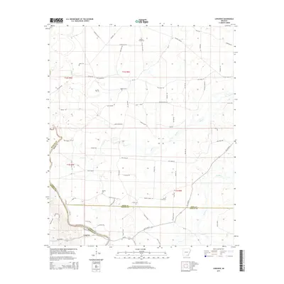
2014 Map of Longview
USGS Topo · Published 2014About this map
The settlement of Longview sits at the confluence of several county boundaries where the Saline River meets the local creek systems of Bradley Co and Drew Co. This map reveals a landscape defined by its rural transit history, featuring a network of old trails and logging corridors like the Wilmar Tram RD and Mayo Trl that wind through the timberlands. The area is heavily marked by its genealogical record, preserved in numerous burial grounds such as Sixteenth Section Cem, Prairie Chapel Cem, and Mt Peter Cem. These sites, along with landings like Gees Landing Rd and Dyson Landing Rd, suggest a river-centered economy where small communities and family plots were established along the fertile banks of Brown Cr and Flat Cr.
Find a feature on this map
73 named features on this map. Tap any name to fly to it.
Don’t see what you’re looking for? This feature index may not catch every label — zoom into the map to look around manually.
Map Details
Editions of this 2014 Longview Map
This is the sole edition of this map. No revisions or reprints were ever made.
Other maps of this area

1934 · Ingalls
USGS Topo · 1:48,000

1937 · Ingalls
USGS Topo · 1:62,500

1939 · Ingalls
USGS Topo · 1:62,500

1952 · Fountain Hill
USGS Topo · 1:24,000

1953 · Greenwood
USGS Topo · 1:250,000

1953 · El Dorado
USGS Topo · 1:250,000

1956 · Greenwood
USGS Topo · 1:250,000

1957 · El Dorado
USGS Topo · 1:250,000

1958 · El Dorado
USGS Topo · 1:250,000

1960 · El Dorado
USGS Topo · 1:250,000