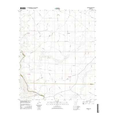
2017 Map of Longview
USGS Topo · Published 2017About this map
Saline River winding through the bottomlands defines the geography of this southern Arkansas landscape. Near the river's bend sits the settlement of Longview, a location established within the township boundaries of t15s r9w and t15s r8w. The terrain is characterized by the intricate drainage patterns and wetlands surrounding the river as it flows toward the county line. This 2017 survey reflects the modern road network and land divisions that have shaped the area's development, providing a clear view of the interface between the river's natural course and the rural infrastructure of Bradley County.
Find a feature on this map
6 named features on this map. Tap any name to fly to it.
Don’t see what you’re looking for? This feature index may not catch every label — zoom into the map to look around manually.
Map Details
Editions of this 2017 Longview Map
This is the sole edition of this map. No revisions or reprints were ever made.
Other maps of this area

1934 · Ingalls
USGS Topo · 1:48,000

1937 · Ingalls
USGS Topo · 1:62,500

1939 · Ingalls
USGS Topo · 1:62,500

1952 · Fountain Hill
USGS Topo · 1:24,000

1953 · Greenwood
USGS Topo · 1:250,000

1953 · El Dorado
USGS Topo · 1:250,000

1956 · Greenwood
USGS Topo · 1:250,000

1957 · El Dorado
USGS Topo · 1:250,000

1958 · El Dorado
USGS Topo · 1:250,000

1960 · El Dorado
USGS Topo · 1:250,000