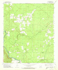
1971 Map of Longview
USGS Topo · Published 1973About this map
The Saline River winds through the southwestern reaches of this Arkansas landscape, defining the border between Bradley and Drew counties. Near its banks, the settlement of Longview and the river crossing at Gees Landing anchor a region characterized by small-scale farming and timber interests. The map reveals a dense network of family and community landmarks, particularly evident in the high concentration of small burial grounds such as 16th Section Cem, Hales Cem, and Ozment Cem.
Find a feature on this map
19 named features on this map. Tap any name to fly to it.
Don’t see what you’re looking for? This feature index may not catch every label — zoom into the map to look around manually.
Map Details
Editions of this 1971 Longview Map
This is the sole edition of this map. No revisions or reprints were ever made.
Other maps of this area

1934 · Ingalls
USGS Topo · 1:48,000

1937 · Ingalls
USGS Topo · 1:62,500

1939 · Ingalls
USGS Topo · 1:62,500

1952 · Fountain Hill
USGS Topo · 1:24,000

1953 · Greenwood
USGS Topo · 1:250,000

1953 · El Dorado
USGS Topo · 1:250,000

1956 · Greenwood
USGS Topo · 1:250,000

1957 · El Dorado
USGS Topo · 1:250,000

1958 · El Dorado
USGS Topo · 1:250,000

1960 · El Dorado
USGS Topo · 1:250,000