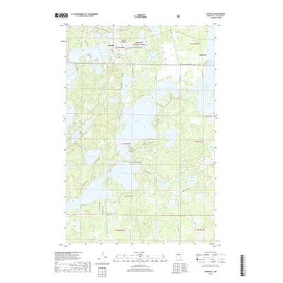
2019 Map of Longville
USGS Topo · Published 2019About this map
Chippewa National Forest defines the lake-studded landscape of northern Cass County, where the settlement of Longville serves as a central hub for the surrounding glacial waters. The map reveals an intricate network of aquatic connectivity, with the Boy River flowing through a series of major water bodies including Girl Lake, Little Boy Lake, and Inguadona Lake. This area, heavily shaped by its timber and recreation history, is crisscrossed by specialized routes like the Triville Gia Snowmobile Trail and the Lost Girl Gia Snowmobile Trail. Genealogists will find local history anchored at the Riverside Cem near the Longville Municipal Airport and the Wabedo Cem further south. The map provides a detailed view of the 2019 infrastructure, from the secluded shorelines of Heffron Lake and Hunter Lake to the more developed surroundings of the primary lakes.
Find a feature on this map
85 named features on this map. Tap any name to fly to it.
Don’t see what you’re looking for? This feature index may not catch every label — zoom into the map to look around manually.
Map Details
Editions of this 2019 Longville Map
This is the sole edition of this map. No revisions or reprints were ever made.
Other maps of this area

1953 · Brainerd
USGS Topo · 1:250,000

1954 · Bemidji
USGS Topo · 1:250,000

1957 · Brainerd
USGS Topo · 1:250,000

1957 · Bemidji
USGS Topo · 1:250,000

1958 · Bemidji
USGS Topo · 1:250,000

1958 · Brainerd
USGS Topo · 1:250,000

1965 · Brainerd
USGS Topo · 1:250,000

1970 · Laura Lake
USGS Topo · 1:24,000
1970 · Mitchell Lake
USGS Topo · 1:24,000

1970 · Woman Lake
USGS Topo · 1:24,000