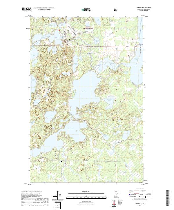
2022 Map of Longville
USGS Topo · Published 2022About this map
Longville serves as the central hub of this lakeside landscape within the Chippewa National Forest. The geography is defined by a dense network of connected water bodies, including Woman Lake, Little Boy Lake, and Wabedo Lake, which are linked by waterways such as the Boy River and Trelipe Creek. This map captures a modern snapshot of a region deeply invested in seasonal recreation and conservation, featuring the Boy River Canoe Route Trl and various snowmobile paths like the Triville Gia Snowmobile Trl. The inclusion of the Longville Municipal Airport and localized sites like Riverside Cem and Wabedo Cem provides essential reference points for genealogists tracing families in the smaller settlement of Inguadona or the surrounding townships of t141n r28w and t140n r28w.
Find a feature on this map
92 named features on this map. Tap any name to fly to it.
Don’t see what you’re looking for? This feature index may not catch every label — zoom into the map to look around manually.
Map Details
Editions of this 2022 Longville Map
This is the sole edition of this map. No revisions or reprints were ever made.
Other maps of this area

1953 · Brainerd
USGS Topo · 1:250,000

1954 · Bemidji
USGS Topo · 1:250,000

1957 · Brainerd
USGS Topo · 1:250,000

1957 · Bemidji
USGS Topo · 1:250,000

1958 · Bemidji
USGS Topo · 1:250,000

1958 · Brainerd
USGS Topo · 1:250,000

1965 · Brainerd
USGS Topo · 1:250,000

1970 · Laura Lake
USGS Topo · 1:24,000
1970 · Mitchell Lake
USGS Topo · 1:24,000

1970 · Woman Lake
USGS Topo · 1:24,000