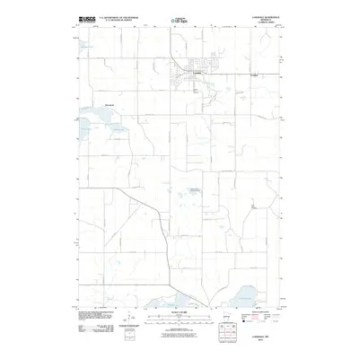
2010 Map of Lonsdale
USGS Topo · Published 2010About this map
The settlement of Lonsdale forms the primary hub of this Rice County landscape, characterized by its residential street grid including Railway St SW and Main St S. To the west, the smaller communities of Wheatland and the cluster at Trondjem to the east reveal the dispersed nature of local agricultural and cemetery sites such as Calvary Hill Cemetery and Saint Johns Cemetery. The geography is defined by numerous water bodies, ranging from the large Mazaska Lake and Shields Lake in the south to the cluster of Phelps Lake, Duban Lake, and Metogga Lake in the northwest.
Find a feature on this map
49 named features on this map. Tap any name to fly to it.
Don’t see what you’re looking for? This feature index may not catch every label — zoom into the map to look around manually.
Map Details
Editions of this 2010 Lonsdale Map
This is the sole edition of this map. No revisions or reprints were ever made.
Other maps of this area

1953 · Saint Paul
USGS Topo · 1:250,000

1957 · Prior Lake
USGS Topo · 1:62,500

1957 · New Prague
USGS Topo · 1:62,500

1959 · Saint Paul
USGS Topo · 1:250,000

1960 · Faribault
USGS Topo · 1:24,000

1960 · Shieldsville
USGS Topo · 1:24,000

1960 · Lonsdale
USGS Topo · 1:24,000

1960 · Little Chicago
USGS Topo · 1:24,000

1966 · Montgomery
USGS Topo · 1:24,000
1966 · Kilkenny
USGS Topo · 1:24,000