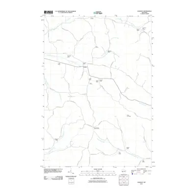
2010 Map of Lookout
USGS Topo · Published 2010About this map
Lookout serves as the central point of this Western Wisconsin landscape, situated where Lookout Valley meets the branching coulees of the Driftless Area. The map reveals a settlement pattern defined by narrow valleys named for early families, such as Wolf Valley, Rognholt Valley, and Cooke Valley. These protected lowlands provided the primary corridors for development and agriculture, while the high ground of Silver Fox Ridge and surrounding bluffs remained less accessible.
Find a feature on this map
66 named features on this map. Tap any name to fly to it.
Don’t see what you’re looking for? This feature index may not catch every label — zoom into the map to look around manually.
Map Details
Editions of this 2010 Lookout Map
This is the sole edition of this map. No revisions or reprints were ever made.
Other maps of this area

1926 · Whitehall
USGS Topo · 1:62,500

1927 · Strum
USGS Topo · 1:62,500

1929 · Whitehall
USGS Topo · 1:62,500

1930 · Strum
USGS Topo · 1:62,500

1932 · Gilmanton
USGS Topo · 1:62,500

1932 · Mondovi
USGS Topo · 1:62,500

1953 · Eau Claire
USGS Topo · 1:250,000

1958 · Eau Claire
USGS Topo · 1:250,000

1964 · Eau Claire
USGS Topo · 1:250,000
1973 · Strum
USGS Topo · 1:24,000