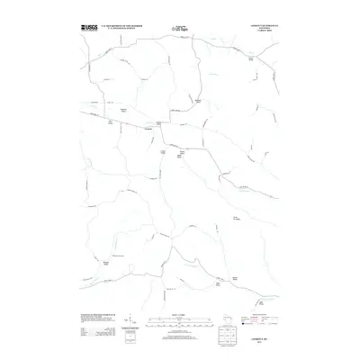
2013 Map of Lookout
USGS Topo · Published 2013About this map
The settlement of Lookout serves as the focal point of this 2013 survey of Buffalo County, Wisconsin, where the landscape is defined by a dense network of coulees and ridges. The naming conventions of the area reflect a deep history of family landownership and agricultural settlement, seen in features like Rognholt Valley, Cooke Valley, and Kilness Valley. These deep-cut drainages, including Wolf Valley and Happy Valley, funnel towards larger waterways such as Waumandee Cr and Traverse Valley Cr.
Find a feature on this map
63 named features on this map. Tap any name to fly to it.
Don’t see what you’re looking for? This feature index may not catch every label — zoom into the map to look around manually.
Map Details
Editions of this 2013 Lookout Map
This is the sole edition of this map. No revisions or reprints were ever made.
Other maps of this area

1926 · Whitehall
USGS Topo · 1:62,500

1927 · Strum
USGS Topo · 1:62,500

1929 · Whitehall
USGS Topo · 1:62,500

1930 · Strum
USGS Topo · 1:62,500

1932 · Gilmanton
USGS Topo · 1:62,500

1932 · Mondovi
USGS Topo · 1:62,500

1953 · Eau Claire
USGS Topo · 1:250,000

1958 · Eau Claire
USGS Topo · 1:250,000

1964 · Eau Claire
USGS Topo · 1:250,000
1973 · Strum
USGS Topo · 1:24,000