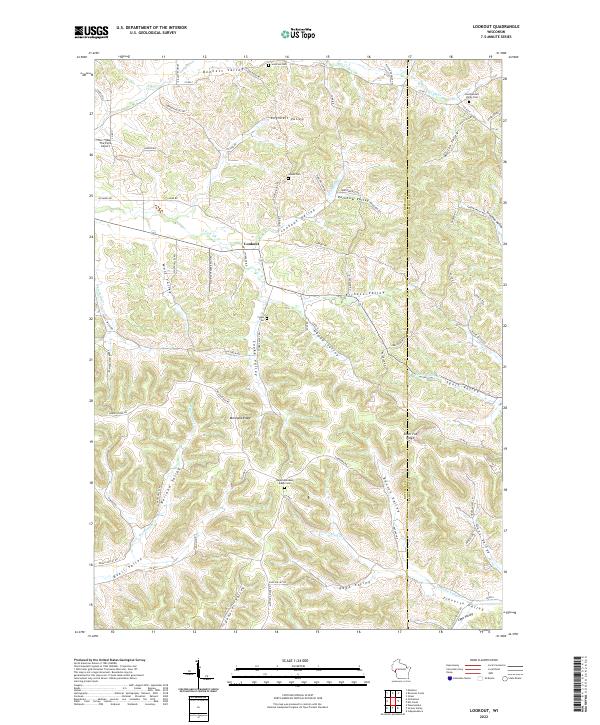
2022 Map of Lookout
USGS Topo · Published 2022About this map
Lookout serves as a central point in this rural landscape, which is defined by a dense network of coulees and ridges along the Buffalo Co and Trempealeau Co border. The map reveals a deeply etched topography where family-named landforms like Bennett Valley, Cooke Valley, and Austen Valley dictate the placement of roads and farmsteads. This pattern of naming extending to the ridges, such as Montana Ridge and Silver Fox Ridge, reflects a long history of local land ownership and lineage. Genealogists will find significant value in the distribution of rural burial grounds, including the Upper Montana Ridge Cem and the East Bennett Valley Cem. The drainage patterns of Waumandee Cr and Traverse Valley Cr carve through the terrain, creating the distinct valleys that have supported this agricultural community for generations.
Find a feature on this map
89 named features on this map. Tap any name to fly to it.
Don’t see what you’re looking for? This feature index may not catch every label — zoom into the map to look around manually.
Map Details
Editions of this 2022 Lookout Map
This is the sole edition of this map. No revisions or reprints were ever made.
Other maps of this area

1926 · Whitehall
USGS Topo · 1:62,500

1927 · Strum
USGS Topo · 1:62,500

1929 · Whitehall
USGS Topo · 1:62,500

1930 · Strum
USGS Topo · 1:62,500

1932 · Gilmanton
USGS Topo · 1:62,500

1932 · Mondovi
USGS Topo · 1:62,500

1953 · Eau Claire
USGS Topo · 1:250,000

1958 · Eau Claire
USGS Topo · 1:250,000

1964 · Eau Claire
USGS Topo · 1:250,000
1973 · Strum
USGS Topo · 1:24,000