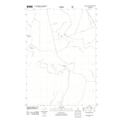
2011 Map of Lookout Butte
USGS Topo · Published 2011About this map
Henrys Fork snakes through this high-country landscape, marked by significant river crossings and natural drops like Sheep Falls and Hatchery Ford. The terrain is defined by the massive rise of Big Bend Ridge to the south and the prominent elevation of Lookout Butte, creating a complex geography of canyons and drainages. The map reveals an area utilized for resource extraction, specifically at Free Use Canyon Number 1 and Free Use Canyon Number 2, located along the western edge near Rattlesnake Creek.
Find a feature on this map
30 named features on this map. Tap any name to fly to it.
Don’t see what you’re looking for? This feature index may not catch every label — zoom into the map to look around manually.
Map Details
Editions of this 2011 Lookout Butte Map
This is the sole edition of this map. No revisions or reprints were ever made.
Other maps of this area

1955 · Ashton
USGS Topo · 1:250,000

1958 · Ashton
USGS Topo · 1:250,000

1960 · Ashton
USGS Topo · 1:250,000

1964 · Hatchery Butte
USGS Topo · 1:24,000

1964 · Last Chance
USGS Topo · 1:24,000

1965 · Lemon Lake
USGS Topo · 1:24,000

1965 · Ashton
USGS Topo · 1:24,000

1965 · Lookout Butte
USGS Topo · 1:24,000

1965 · Snake River Butte
USGS Topo · 1:24,000

1965 · Blue Creek Reservoir
USGS Topo · 1:24,000