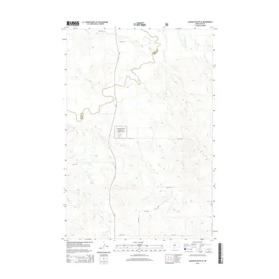
2014 Map of Lookout Butte SE
USGS Topo · Published 2014About this map
Cedar River National Grassland dominates this portion of the northern plains, where the open landscape is defined by its drainage basins and section-line roads. The border between Grant and Sioux counties cuts across the northern terrain, following the winding course of Cedar Cr. This 2014 survey documents the rugged cattle country of the Porcupine District, showing how modern infrastructure like Nd-31 and a grid of rural routes such as 95th St SW navigate the upland plateaus. Small seasonal waterways like Roger Cr and the descriptively named Leaf on the Hill Cr carve out the topography between the rolling buttes. The map provides a precise record of land management and transportation in this sparsely populated region of North Dakota, tracing the persistent boundaries of public lands and the local road network that connects the scattered ranchlands.
Find a feature on this map
14 named features on this map. Tap any name to fly to it.
Don’t see what you’re looking for? This feature index may not catch every label — zoom into the map to look around manually.
Map Details
Editions of this 2014 Lookout Butte SE Map
This is the sole edition of this map. No revisions or reprints were ever made.
Other maps of this area

1953 · McIntosh
USGS Topo · 1:250,000

1954 · Bismarck
USGS Topo · 1:250,000

1958 · Bismarck
USGS Topo · 1:250,000

1958 · McIntosh
USGS Topo · 1:250,000

1971 · Lookout Butte
USGS Topo · 1:24,000

1971 · Shields SW
USGS Topo · 1:24,000

1971 · Shields
USGS Topo · 1:24,000

1971 · Lookout Butte SE
USGS Topo · 1:24,000

1972 · Hump Butte
USGS Topo · 1:24,000

1972 · McIntosh
USGS Topo · 1:24,000