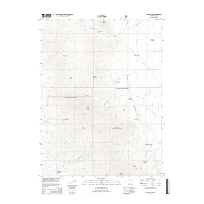
2014 Map of Lookout Pass
USGS Topo · Published 2014About this map
Lookout Pass serves as a critical geographic transition point between the Onaqui Mountains and the Sheeprock Mountains in this high-elevation corridor of Tooele County. The landscape is defined by the protected acreage of the Wasatch National Forest, where steep canyons like Spring Canyon and Little Red Pine Canyon drain toward the Rush Valley floor. A complex network of backcountry routes, including the Lookout Pass Rd and Red Pine Mountain Rd, provide access to prominent peaks such as Red Pine Mtn and Lion Hill. Water sources are vital but scattered in this arid terrain, marked by features such as Copper Spring, Hill Spring, and the seasonal flows of E Government Cr. This survey documents the intersection of federal forest lands and township boundaries just before the mid-2010s.
Find a feature on this map
38 named features on this map. Tap any name to fly to it.
Don’t see what you’re looking for? This feature index may not catch every label — zoom into the map to look around manually.
Map Details
Editions of this 2014 Lookout Pass Map
This is the sole edition of this map. No revisions or reprints were ever made.
Other maps of this area

1885 · Sevier Desert
USGS Topo · 1:250,000

1885 · Tooele Valley
USGS Topo · 1:250,000

1953 · Tooele
USGS Topo · 1:250,000

1953 · Delta
USGS Topo · 1:250,000

1955 · Indian Peaks
USGS Topo · 1:24,000

1955 · Indian Springs
USGS Topo · 1:24,000

1955 · Davis Knolls
USGS Topo · 1:24,000

1955 · Tooele
USGS Topo · 1:250,000

1958 · Delta
USGS Topo · 1:250,000

1962 · Delta
USGS Topo · 1:250,000