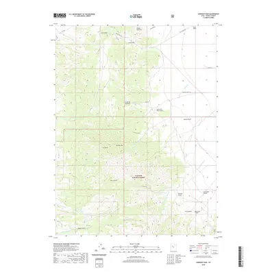
2020 Map of Lookout Pass
USGS Topo · Published 2020About this map
Lookout Pass serves as a critical geographic pivot point where the Onaqui Mountains meet the Sheeprock Mountains in this modern topographic study. The map traces the historical path of the Pony Express Rd, which skirts the northern edge of the peaks, transitioning from Little Valley toward the expansive Rush Valley. This corridor remains a vital link through the high desert, maintaining the original transit patterns established over a century ago. To the south, the landscape is defined by the protected boundaries of the Wasatch National Forest, where steep drainages like Rock Canyon and North Pine Canyon descend from Red Pine Mtn. The presence of scattered water sources such as Hill Spring, Copper Spring, and Coyote Spring highlights the precious nature of hydrology in this high-elevation terrain, dictating the placement of primitive routes like Sheeprock Front Rd and Fenceline Rd.
Find a feature on this map
30 named features on this map. Tap any name to fly to it.
Don’t see what you’re looking for? This feature index may not catch every label — zoom into the map to look around manually.
Map Details
Editions of this 2020 Lookout Pass Map
This is the sole edition of this map. No revisions or reprints were ever made.
Other maps of this area

1885 · Sevier Desert
USGS Topo · 1:250,000

1885 · Tooele Valley
USGS Topo · 1:250,000

1953 · Tooele
USGS Topo · 1:250,000

1953 · Delta
USGS Topo · 1:250,000

1955 · Indian Peaks
USGS Topo · 1:24,000

1955 · Indian Springs
USGS Topo · 1:24,000

1955 · Davis Knolls
USGS Topo · 1:24,000

1955 · Tooele
USGS Topo · 1:250,000

1958 · Delta
USGS Topo · 1:250,000

1962 · Delta
USGS Topo · 1:250,000