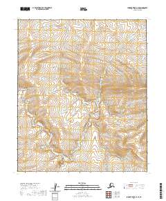
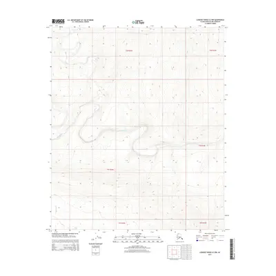
2020 Map of Lookout Ridge B-3 SE
USGS Topo · Published 2020About this map
Discovery Creek meanders through this portion of the Lookout Ridge B-3 SE quadrangle, carving a distinct drainage pattern into the terrain. The landscape is defined by its natural topography, where the watercourse—also labeled as Discovery Cr in certain stretches—serves as the primary geographic focal point. This 2020 edition from the U.S. Geological Survey details the Public Land Survey System divisions, including sections of t1s r23w and t2s r23w. The map provides a clear picture of the hydrological flow in this part of the North Slope, where seasonal drainage and elevation contours reveal the raw character of the Alaskan interior before any significant modern infrastructure or permanent settlement reached these coordinates.
Find a feature on this map
6 named features on this map. Tap any name to fly to it.
Don’t see what you’re looking for? This feature index may not catch every label — zoom into the map to look around manually.
Map Details
Editions of this 2020 Lookout Ridge B-3 SE Map
This is the sole edition of this map. No revisions or reprints were ever made.
Other maps of this area

1951 · Lookout Ridge
USGS Topo · 1:250,000

1956 · Lookout Ridge
USGS Topo · 1:250,000
1984 · Lookout Ridge A-2
USGS Topo · 1:63,360
1984 · Lookout Ridge A-3
USGS Topo · 1:63,360
1985 · Lookout Ridge B-2
USGS Topo · 1:63,360
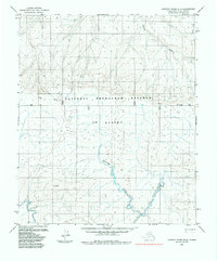
1985 · Lookout Ridge B-3
USGS Topo · 1:63,360
2013 · Lookout Ridge B-3 NE
USGS Topo · 1:25,000
2015 · Lookout Ridge B-3 SW
USGS Topo · 1:25,000
2015 · Lookout Ridge B-3 NW
USGS Topo · 1:25,000
2015 · Lookout Ridge A-3 NW
USGS Topo · 1:25,000