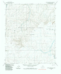
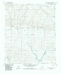
1985 Map of Lookout Ridge B-4
USGS Topo · Published 1985About this map
The National Petroleum Reserve in Alaska dominates this 1985 survey, providing a detailed look at the North Slope's remote interior hydrology and surveying markers. The landscape is defined by the winding course of the Kaksu River in the northwest and Liti Creek further south. This map captures a specific moment in the management of these public lands, showing the intersection of natural drainage systems with the rigid administrative grid of the Base Line and various township boundaries. Scattered across this vast expanse are isolated points of interest such as John, Let, and Dam, which likely served as remote monitoring or survey markers. A lonely Tractor Trail provides the only evidence of overland transportation, reflecting the logistical challenges of surveying and exploring this region before modern infrastructure was established.
Find a feature on this map
14 named features on this map. Tap any name to fly to it.
Don’t see what you’re looking for? This feature index may not catch every label — zoom into the map to look around manually.
Map Details
Editions of this 1985 Lookout Ridge B-4 Map
This is the sole edition of this map. No revisions or reprints were ever made.
Other maps of this area

1951 · Lookout Ridge
USGS Topo · 1:250,000

1956 · Lookout Ridge
USGS Topo · 1:250,000
1984 · Lookout Ridge C-5
USGS Topo · 1:63,360
1984 · Lookout Ridge A-4
USGS Topo · 1:63,360
1984 · Lookout Ridge A-3
USGS Topo · 1:63,360
1984 · Lookout Ridge A-5
USGS Topo · 1:63,360
1984 · Lookout Ridge C-4
USGS Topo · 1:63,360
1985 · Lookout Ridge B-5
USGS Topo · 1:63,360
1985 · Lookout Ridge C-3
USGS Topo · 1:63,360
1985 · Lookout Ridge B-3
USGS Topo · 1:63,360