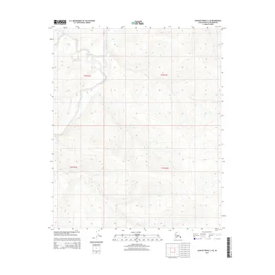
2015 Map of Lookout Ridge C-3 SE
USGS Topo · Published 2015About this map
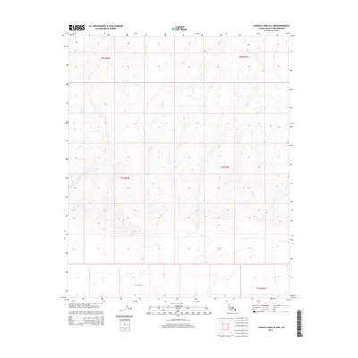
Meade River defines the drainage of this Arctic landscape in the Alaskan North Slope, winding through the western portion of the region. The terrain is characterized by a series of high ridges and valleys typical of the northern foothills. Tributaries like Shaningarok Creek in the northwest and Pahrori Cr in the southwest emphasize the complex hydrological network that feeds the larger coastal systems. While the map is devoid of human settlements or structures, the detailed contour lines and public land survey system grid, including townships like t3n r23w and t2n r22w, reflect the precise mapping of this remote wilderness in the early twenty-first century.
Find a feature on this map
7 named features on this map. Tap any name to fly to it.
Don’t see what you’re looking for? This feature index may not catch every label — zoom into the map to look around manually.
Map Details
Editions of this 2015 Lookout Ridge C-3 SE Map
This is the sole edition of this map. No revisions or reprints were ever made.
Other maps of this area

1951 · Lookout Ridge
USGS Topo · 1:250,000

1956 · Lookout Ridge
USGS Topo · 1:250,000
1985 · Lookout Ridge B-2
USGS Topo · 1:63,360
1985 · Lookout Ridge C-3
USGS Topo · 1:63,360
1985 · Lookout Ridge C-2
USGS Topo · 1:63,360
1985 · Lookout Ridge B-3
USGS Topo · 1:63,360
2013 · Lookout Ridge B-3 NE
USGS Topo · 1:25,000
2015 · Lookout Ridge C-3 NW
USGS Topo · 1:25,000
2015 · Lookout Ridge C-2 SW
USGS Topo · 1:25,000
2015 · Lookout Ridge B-3 NW
USGS Topo · 1:25,000