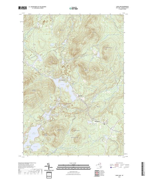
2023 Map of Loon Lake
USGS Topo · Published 2023About this map
Merrillsville and the surrounding woodlands of the Adirondack Park define this landscape within the northern reaches of the park system. The map documents a geography where historic transportation routes are still visible, including the NY Central Railroad Bed Trl and D & H Rd, tracing the former paths of the New York Central and Delaware & Hudson railroads. These rail beds cut through a terrain of high peaks like Loon Lake Mountains and Goldsmith Mountains, connecting remote settlements and seasonal camps.
Find a feature on this map
61 named features on this map. Tap any name to fly to it.
Don’t see what you’re looking for? This feature index may not catch every label — zoom into the map to look around manually.
Map Details
Editions of this 2023 Loon Lake Map
This is the sole edition of this map. No revisions or reprints were ever made.
Other maps of this area

1896 · Lake Placid
USGS Topo · 1:62,500

1898 · Lake Placid
USGS Topo · 1:62,500

1902 · Saranac
USGS Topo · 1:62,500

1904 · Saranac
USGS Topo · 1:62,500

1906 · Loon Lake
USGS Topo · 1:62,500

1908 · Loon Lake
USGS Topo · 1:62,500

1911 · Lyon Mountain
USGS Topo · 1:62,500

1913 · Lyon Mountain
USGS Topo · 1:62,500

1931 · Lyon Mountain
USGS Topo · 1:62,500

1948 · Ogdensburg
USGS Topo · 1:250,000