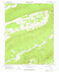
1963 Map of Looney
USGS Topo · Published 1976About this map
Jefferson National Forest dominates this landscape in the early 1960s, defined by the massive parallel ridges of Sinking Creek Mountain and North Mountain. The area is characterized by isolated rural settlements and numerous family burial grounds, such as the Huffman Cem near Looney and the Brickey Cem further south. The Appalachian Trail winds through the southern terrain, crossing over Cove Mountain and passing near the distinctively named Murder Hole.
Find a feature on this map
43 named features on this map. Tap any name to fly to it.
Don’t see what you’re looking for? This feature index may not catch every label — zoom into the map to look around manually.
Map Details
Editions of this 1963 Looney Map
Other maps of this area

1887 · Lewisburg
USGS Topo · 1:125,000

1890 · Christiansburg
USGS Topo · 1:125,000

1891 · Lewisburg
USGS Topo · 1:125,000

1921 · Ronceverte
USGS Topo · 1:48,000

1923 · Ronceverte
USGS Topo · 1:62,500

1923 · Waiteville
USGS Topo · 1:62,500

1929 · Salem
USGS Topo · 1:48,000

1931 · Waiteville
USGS Topo · 1:48,000

1932 · Salem
USGS Topo · 1:62,500

1944 · Waiteville
USGS Topo · 1:62,500