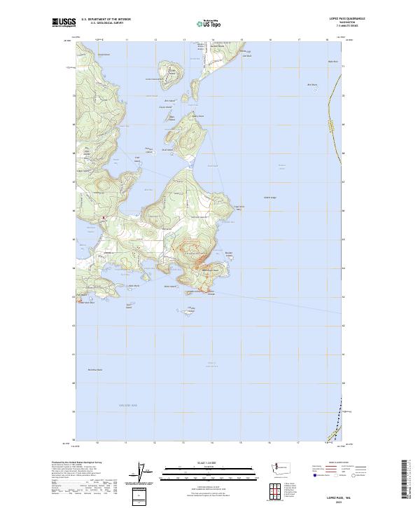
2023 Map of Lopez Pass
USGS Topo · Published 2023About this map
Decatur Island and the southeastern corner of Lopez Island anchor this maritime landscape, where the waters of the Salish Sea meet the Rosario Strait. This modern survey details a complex archipelago of smaller landforms including Center Island, Colville Island, and Fortress Island, many of which fall under the protection of the San Juan Islands National Wilderness. The map reveals how local transportation adapts to the island geography, featuring the Decatur Shores Airport and Center Island Airport alongside a network of coastal roads like Lopez Sound Rd and Mackaye Harbor Rd. From the prominent heights of Chadwick Hill to the sheltered waters of Mud Bay and Hunter Bay, the map documents the established boundaries of the San Juan Islands National Monument, illustrating the balance between private island life and federal conservation.
Find a feature on this map
93 named features on this map. Tap any name to fly to it.
Don’t see what you’re looking for? This feature index may not catch every label — zoom into the map to look around manually.
Map Details
Editions of this 2023 Lopez Pass Map
This is the sole edition of this map. No revisions or reprints were ever made.
Other maps of this area

1943 · Richardson
USGS Topo · 1:62,500

1943 · Orcas Island
USGS Topo · 1:62,500

1943 · Deception Pass
USGS Topo · 1:62,500

1943 · Anacortes
USGS Topo · 1:62,500

1951 · Deception Pass
USGS Topo · 1:62,500

1951 · Anacortes
USGS Topo · 1:62,500

1957 · Richardson
USGS Topo · 1:62,500

1957 · Orcas Island
USGS Topo · 1:62,500

1957 · Victoria
USGS Topo · 1:250,000

1973 · Cypress Island
USGS Topo · 1:24,000