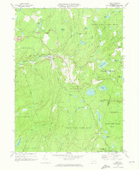
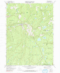
1969 Map of Lopez
USGS Topo · Published 1973About this map
Loyalsock Creek carves through the heart of the Endless Mountains on this late 1960s survey, where the village of Lopez serves as the primary hub of settlement. The landscape is a study in the transition from extraction to conservation, featuring several Strip Mine operations and a Quarry situated alongside expansive protected areas like State Game Lands No 66 and Ricketts Glen State Park. For genealogists, the map preserves the location of St Vladimirs Ch and its accompanying St Vladimirs Cem near the town center.
Find a feature on this map
60 named features on this map. Tap any name to fly to it.
Don’t see what you’re looking for? This feature index may not catch every label — zoom into the map to look around manually.
Map Details
Editions of this 1969 Lopez Map
5 editions found
Other maps of this area

1891 · Harveys Lake
USGS Topo · 1:62,500

1893 · Harvey Lake
USGS Topo · 1:62,500

1934 · Laporte
USGS Topo · 1:62,500

1943 · Monroeton
USGS Topo · 1:62,500

1945 · Meshoppen
USGS Topo · 1:62,500

1945 · Jenningsville
USGS Topo · 1:24,000

1946 · Dutch Mtn
USGS Topo · 1:24,000

1946 · Sweet Valley
USGS Topo · 1:24,000

1947 · Jenningsville
USGS Topo · 1:31,680
1948 · Dutch Mtn
USGS Topo · 1:24,000
Featured Places
- Colley Township, PA
- Forkston Township, PA
- Davidson Township, PA
- Laporte Township, PA
- Murray, Colley Township