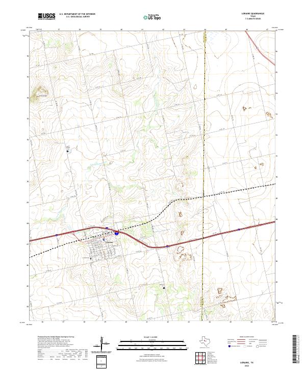
2022 Map of Loraine
USGS Topo · Published 2022About this map
Loraine stands as the primary settlement on this West Texas landscape, organized around a grid of streets including W Pacific Ave, W School Ave, and E Market Ave. The community's spatial history is marked by the presence of Loraine Cem at the southern edge of the townsite, while the surrounding rural landscape in Mitchell Co and Nolan Co is dotted with earlier family and community burial grounds such as Union Chapel Cem and Wallace Cem. The terrain is defined by the winding course of N Fork Champion Cr and the prominent rise of Lone Wolf Mtn to the northwest. This modern survey illustrates how historic ranch roads like FM 1982 and FM 1899 continue to serve the region alongside the major thoroughfare of Interstate 20, which bisects the quadrangle just north of the town center.
Find a feature on this map
66 named features on this map. Tap any name to fly to it.
Don’t see what you’re looking for? This feature index may not catch every label — zoom into the map to look around manually.
Map Details
Editions of this 2022 Loraine Map
This is the sole edition of this map. No revisions or reprints were ever made.
Other maps of this area

1950 · Colorado City SE
USGS Topo · 1:24,000

1952 · China Grove
USGS Topo · 1:24,000

1952 · Colorado City
USGS Topo · 1:24,000

1954 · Big Spring
USGS Topo · 1:250,000

1958 · Big Spring
USGS Topo · 1:250,000

1969 · Baumann School
USGS Topo · 1:24,000

1969 · Bench Mountain
USGS Topo · 1:24,000

1969 · Loraine
USGS Topo · 1:24,000

1969 · Bernecker
USGS Topo · 1:24,000

1969 · Roscoe
USGS Topo · 1:24,000