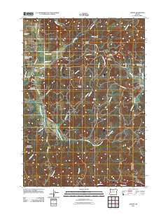
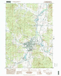
2011 Map of Lorane
USGS Topo · Published 2011About this map
Lorane serves as a central hub for this portion of Lane County, where the Lorane Post Office sits near the junction of Territorial Hwy and Cottage Grove Lorane Rd. The landscape is defined by the headwaters of the South Fork Siuslaw River and numerous creek systems like Crow Creek and Silk Creek that carve through prominent ridges. Genealogical interest is particularly high in this area, which preserves several distinct burial grounds including the Lorane Grange Cemetery, the Crow Family Cemetery, and the uniquely named Independent Order of Good Templars Cemetery. To the south, the settlement of Mill Camp marks a point along the river valley, while the eastern edge features the small community of Royal. The terrain rises toward Lorane Mountain and Bald Butte, with complex road networks like Gowdyville Rd and W Hill Rd providing access to these elevated timberlands.
Find a feature on this map
50 named features on this map. Tap any name to fly to it.
Don’t see what you’re looking for? This feature index may not catch every label — zoom into the map to look around manually.
Map Details
Editions of this 2011 Lorane Map
This is the sole edition of this map. No revisions or reprints were ever made.
Other maps of this area
1921 · Cottage Grove
USGS Topo · 1:62,500
1942 · Crow
USGS Topo · 1:62,500
1945 · Crow
USGS Topo · 1:62,500
1954 · Drain
USGS Topo · 1:62,500
1954 · Anlauf
USGS Topo · 1:62,500
1957 · Cottage Grove
USGS Topo · 1:62,500

1958 · Roseburg
USGS Topo · 1:250,000

1959 · Roseburg
USGS Topo · 1:250,000
1979 · Cottage Grove
USGS Topo · 1:100,000
1984 · Cottage Grove
USGS Topo · 1:24,000