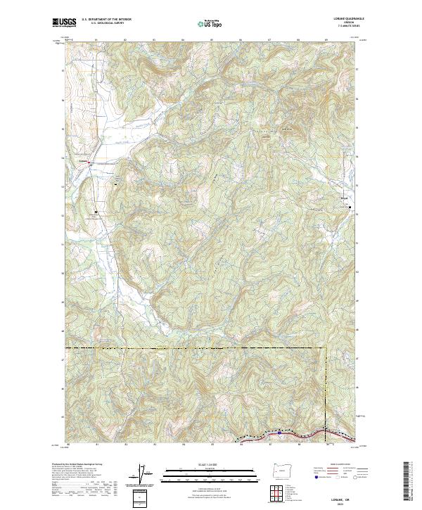
2023 Map of Lorane
USGS Topo · Published 2023About this map
Lorane and the smaller settlement of Royal anchor this landscape where the headwaters of the South Fork Siuslaw River meet the rising elevations of the Coast Range. The terrain is defined by a series of prominent north-south ridges, including Hawley Ridge, Long Ridge, and Green Ridge, which channel numerous tributaries like Snow Creek and Kelley Creek toward the Siuslaw. For family historians, the presence of the Crow Family Cem and the Independent Order of Good Templars Cem provides specific points of interest near the junction of Cottage Grove Lorane Rd and Territorial Ln.
Find a feature on this map
60 named features on this map. Tap any name to fly to it.
Don’t see what you’re looking for? This feature index may not catch every label — zoom into the map to look around manually.
Map Details
Editions of this 2023 Lorane Map
This is the sole edition of this map. No revisions or reprints were ever made.
Other maps of this area

1921 · Cottage Grove
USGS Topo · 1:62,500

1942 · Crow
USGS Topo · 1:62,500

1945 · Crow
USGS Topo · 1:62,500

1954 · Drain
USGS Topo · 1:62,500

1954 · Anlauf
USGS Topo · 1:62,500
1957 · Cottage Grove
USGS Topo · 1:62,500

1958 · Roseburg
USGS Topo · 1:250,000

1959 · Roseburg
USGS Topo · 1:250,000

1979 · Cottage Grove
USGS Topo · 1:100,000
1984 · Cottage Grove
USGS Topo · 1:24,000