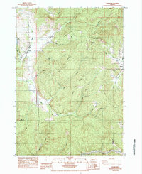
1984 Map of Lorane
USGS Topo · Published 1984About this map
Lorane serves as the primary settlement hub in this 1980s topographic study of the coastal foothills in Southern Lane County. The landscape is defined by the headwaters of the Siuslaw River and its South Fork, which carve through the prominent timberlands of Lorane Mountain. The presence of Mill Camp and a large borrow pit near the river suggests the area’s ongoing industrial and forestry activity during this era.
Find a feature on this map
40 named features on this map. Tap any name to fly to it.
Don’t see what you’re looking for? This feature index may not catch every label — zoom into the map to look around manually.
Map Details
Editions of this 1984 Lorane Map
This is the sole edition of this map. No revisions or reprints were ever made.
Other maps of this area

1921 · Cottage Grove
USGS Topo · 1:62,500

1942 · Crow
USGS Topo · 1:62,500

1945 · Crow
USGS Topo · 1:62,500

1954 · Drain
USGS Topo · 1:62,500

1954 · Anlauf
USGS Topo · 1:62,500
1957 · Cottage Grove
USGS Topo · 1:62,500

1958 · Roseburg
USGS Topo · 1:250,000

1959 · Roseburg
USGS Topo · 1:250,000

1979 · Cottage Grove
USGS Topo · 1:100,000
1984 · Cottage Grove
USGS Topo · 1:24,000