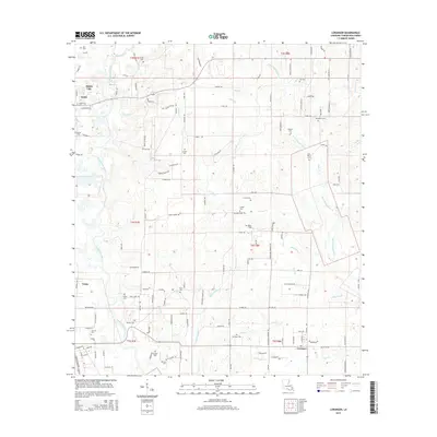
2015 Map of Loranger
USGS Topo · Published 2015About this map
The Tangipahoa River carves the western boundary of this landscape, where the town of Amite City and the settlement of Velma sit along the riverbanks. Moving east, the terrain transitions into a dense network of creek drainages including Little Chappapeela Cr, Scott Cr, and Cooper Cr, which define the rural character of the area around Loranger. This 2015 edition provides a detailed look at the parish's long-standing family and community sites, featuring a high concentration of cemeteries such as Spring Cem, Cutrer Cem, and Briar Patch Cem. The map reveals a highly structured road network, with arteries like Highway 1054 connecting scattered agricultural holdings and aviation landmarks like Le Blanc Field.
Find a feature on this map
128 named features on this map. Tap any name to fly to it.
Don’t see what you’re looking for? This feature index may not catch every label — zoom into the map to look around manually.
Map Details
Editions of this 2015 Loranger Map
This is the sole edition of this map. No revisions or reprints were ever made.
Other maps of this area

1940 · Tickfaw
USGS Topo · 1:31,680

1940 · Roseland
USGS Topo · 1:31,680

1942 · Roseland
USGS Topo · 1:31,680

1942 · Husser
USGS Topo · 1:31,680

1942 · Robert
USGS Topo · 1:31,680

1942 · Wilmer
USGS Topo · 1:31,680

1942 · Loranger
USGS Topo · 1:31,680

1949 · Bolivar
USGS Topo · 1:31,680

1949 · Amite
USGS Topo · 1:31,680

1949 · Albany
USGS Topo · 1:31,680