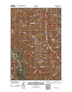
2011 Map of Lord Flat
USGS Topo · Published 2011About this map
The Snake River carves through this borderland between Idaho and Oregon, defining a landscape of high plateaus and steep drainages. Remote agricultural and ranching outposts such as Tryon Creek Ranch and Somers Ranch are positioned near the network of creeks feeding the river, including Lookout Creek and Camp Creek. The presence of the Lord Flat Airport on the elevated expanse of Lord Flat suggests the necessity of aerial access in this isolated backcountry. To the south, Mormon Flat and the Dorrance Cow Camp indicate the area's history of seasonal livestock grazing. Terrain features like Tryon Saddle and Englishman Hill provide significant navigational landmarks for those traversing the heights above Deep Creek and the river canyon. This survey illustrates the persistence of traditional land use in a region where the geography dictates the placement of every trail and camp.
Find a feature on this map
33 named features on this map. Tap any name to fly to it.
Don’t see what you’re looking for? This feature index may not catch every label — zoom into the map to look around manually.
Map Details
Editions of this 2011 Lord Flat Map
This is the sole edition of this map. No revisions or reprints were ever made.
Other maps of this area

1954 · Kernan Point
USGS Topo · 1:62,500

1955 · Grangeville
USGS Topo · 1:250,000

1959 · Grangeville
USGS Topo · 1:250,000

1963 · Cactus Mtn
USGS Topo · 1:24,000

1963 · Kirkwood Creek
USGS Topo · 1:24,000

1963 · Joseph
USGS Topo · 1:24,000

1963 · Grave Point
USGS Topo · 1:24,000

1963 · Wolf Creek
USGS Topo · 1:24,000

1980 · Grangeville
USGS Topo · 1:100,000
1990 · Sleepy Ridge
USGS Topo · 1:24,000