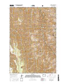
2017 Map of Lord Flat
USGS Topo · Published 2017About this map
Snake River navigation and high-elevation plateaus define this borderland where Oregon and Idaho meet. This 2017 survey details the dramatic transition from the river canyon floor to the surrounding highlands of the Wallowa National Forest and Nez Perce National Forest. The river course is marked by significant water features including Cottonwood Rapids, Somers Creek Rapids, and Davis Creek Rapids, illustrating the challenging hydrology of the canyon. Above the water, names like Lord Flat, Mormon Flat, and Englishman Hill suggest a history of localized grazing and early land use. The topography is deeply dissected by drainages such as Buckaroo Gulch, Cache Canyon, and Big Canyon Cr, while access is maintained via the remote Highrange Road and Lookout Road.
Find a feature on this map
45 named features on this map. Tap any name to fly to it.
Don’t see what you’re looking for? This feature index may not catch every label — zoom into the map to look around manually.
Map Details
Editions of this 2017 Lord Flat Map
This is the sole edition of this map. No revisions or reprints were ever made.
Other maps of this area

1954 · Kernan Point
USGS Topo · 1:62,500

1955 · Grangeville
USGS Topo · 1:250,000

1959 · Grangeville
USGS Topo · 1:250,000

1963 · Cactus Mtn
USGS Topo · 1:24,000

1963 · Kirkwood Creek
USGS Topo · 1:24,000

1963 · Joseph
USGS Topo · 1:24,000

1963 · Grave Point
USGS Topo · 1:24,000

1963 · Wolf Creek
USGS Topo · 1:24,000

1980 · Grangeville
USGS Topo · 1:100,000
1990 · Sleepy Ridge
USGS Topo · 1:24,000