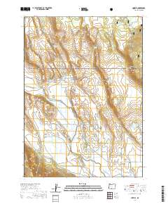
2020 Map of Lorella
USGS Topo · Published 2020About this map
Lorella sits at the southern edge of this Klamath County landscape, serving as a focal point for the agricultural and water management systems in the valley. The terrain transitions from the low-lying Wolf Flat and Capon Flat to the rising elevations of the Fremont National Forest in the north. Significant investment in irrigation is evident through a network of water-moving infrastructure, including the Low Line Ditch, High Line Ditch, and Lorella Lateral, which support the surrounding ranchlands. The Lost River meanders through the central region, crossed by the Keller Bridge, while numerous reservoirs such as Olive Reservoir and Mahoney Reservoir dot the higher ground. Local landmarks like Dead Indian Hill and Goodlow Rim define the edges of the valley, providing clear reference points for researchers studying the geographic layout and historical development of this rural Oregon community.
Find a feature on this map
40 named features on this map. Tap any name to fly to it.
Don’t see what you’re looking for? This feature index may not catch every label — zoom into the map to look around manually.
Map Details
Editions of this 2020 Lorella Map
This is the sole edition of this map. No revisions or reprints were ever made.
Other maps of this area

1889 · Klamath
USGS Topo · 1:250,000

1894 · Klamath
USGS Topo · 1:250,000

1955 · Klamath Falls
USGS Topo · 1:250,000

1957 · Malin
USGS Topo · 1:62,500

1958 · Klamath Falls
USGS Topo · 1:250,000

1960 · Gerber Reservoir
USGS Topo · 1:62,500

1960 · Bly
USGS Topo · 1:62,500

1960 · Beatty
USGS Topo · 1:62,500
1988 · Bryant Mountain
USGS Topo · 1:24,000
1988 · Malin
USGS Topo · 1:24,000