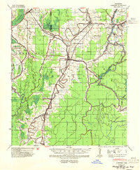
1939 Map of Lorenzen
USGS Topo · Published 1954About this map
Rolling Fork serves as the central hub of this Delta landscape, where the Yazoo and Mississippi Valley and Illinois Central railroads converge to move agricultural goods. The terrain is defined by a dense network of meandering waterways, including Steele Bayou and the wide Big Sunflower River, which wrap around agricultural tracks and small settlements like Egremont and Lorenzen. These rail lines were the lifeblood of the region, connecting isolated landings and junctions such as Riverside Jct to the larger Mississippi trade network.
Find a feature on this map
50 named features on this map. Tap any name to fly to it.
Don’t see what you’re looking for? This feature index may not catch every label — zoom into the map to look around manually.
Map Details
Editions of this 1939 Lorenzen Map
2 editions found
Other maps of this area

1909 · Wilsons Point
USGS Topo · 1:24,000

1913 · Wilson Point
USGS Topo · 1:31,680

1939 · Onward
USGS Topo · 1:62,500

1939 · Lorenzen
USGS Topo · 1:62,500

1939 · Readland
USGS Topo · 1:62,500

1939 · Alsatia
USGS Topo · 1:62,500

1939 · Mayersville
USGS Topo · 1:62,500

1939 · Swan Lake
USGS Topo · 1:62,500

1940 · Auter
USGS Topo · 1:62,500

1940 · Mechanicsburg
USGS Topo · 1:62,500