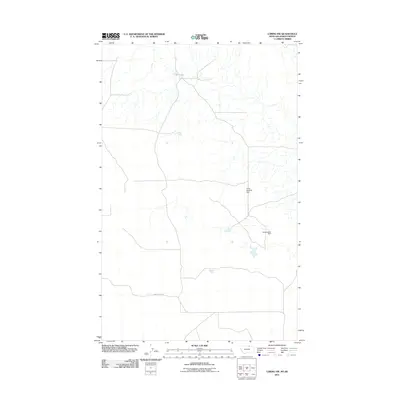
2011 Map of Loring NW
USGS Topo · Published 2011About this map
Three Hundred Dam and Demontigny Dam mark this high-latitude borderlands landscape in Phillips County, just south of the international boundary between Montana and Saskatchewan. The terrain is defined by a sparse network of secondary roads and drainage systems, where small water management structures like these dams were essential for supporting ranching and agricultural operations in an arid environment. The road network, including Sunny Slope Rd, follows a strictly rectangular grid, reflecting the systematic land division of the American West as it persisted into the early 21st century. This map captures the intersection of local water infrastructure and the geometric order of the northern plains, showing a region where human modification is focused almost entirely on capturing surface runoff for livestock and irrigation.
Find a feature on this map
3 named features on this map. Tap any name to fly to it.
Don’t see what you’re looking for? This feature index may not catch every label — zoom into the map to look around manually.
Map Details
Editions of this 2011 Loring NW Map
This is the sole edition of this map. No revisions or reprints were ever made.
Other maps of this area

1920 · Avery
USGS Topo · 1:125,000

1920 · Cowan
USGS Topo · 1:125,000

1953 · Havre
USGS Topo · 1:250,000

1954 · Glasgow
USGS Topo · 1:250,000

1957 · Glasgow
USGS Topo · 1:250,000

1957 · Havre
USGS Topo · 1:250,000

1958 · Glasgow
USGS Topo · 1:250,000

1958 · Havre
USGS Topo · 1:250,000

1984 · Morgan
USGS Topo · 1:24,000
1984 · Loring NW
USGS Topo · 1:24,000