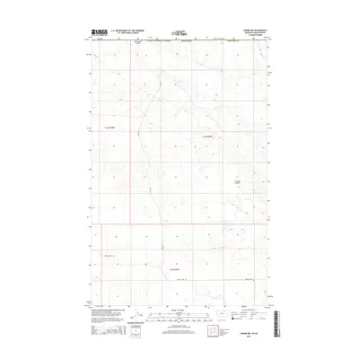
2014 Map of Loring NW
USGS Topo · Published 2014About this map
Cottonwood Coulee defines the northern edge of this high plains landscape, situated immediately south of the international border where the United States and Montana meet the Canadian frontier. This 2014 survey of Phillips County reveals a vast, open topography marked by intermittent drainage patterns and a sparse network of section-line roads. The terrain is characterized by gradual elevation changes and natural depressions like Lone Tree Coulee, which provides a focal point for local drainage in the eastern portion of the quadrangle. Human presence is delineated primarily through property boundaries and long-stretching thoroughfares such as Webb Rd and Sunny Slope Rd, reflecting the large-scale agricultural and ranching divisions typical of the northern Montana prairie.
Find a feature on this map
9 named features on this map. Tap any name to fly to it.
Don’t see what you’re looking for? This feature index may not catch every label — zoom into the map to look around manually.
Map Details
Editions of this 2014 Loring NW Map
This is the sole edition of this map. No revisions or reprints were ever made.
Other maps of this area

1920 · Avery
USGS Topo · 1:125,000

1920 · Cowan
USGS Topo · 1:125,000

1953 · Havre
USGS Topo · 1:250,000

1954 · Glasgow
USGS Topo · 1:250,000

1957 · Glasgow
USGS Topo · 1:250,000

1957 · Havre
USGS Topo · 1:250,000

1958 · Glasgow
USGS Topo · 1:250,000

1958 · Havre
USGS Topo · 1:250,000

1984 · Morgan
USGS Topo · 1:24,000
1984 · Loring NW
USGS Topo · 1:24,000