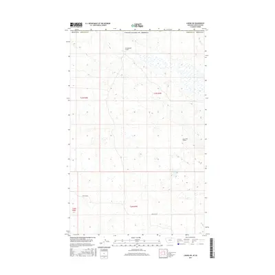
2017 Map of Loring NW
USGS Topo · Published 2017About this map
Cottonwood Coulee and Lone Tree Coulee define the drainage patterns of this high plains landscape along the international boundary between the United States of America and Canada. Located in the northern reaches of Phillips County, the map reveals a sparsely populated terrain dominated by the Public Land Survey System grids of t37n r28e, t37n r29e, and t36n r29e. This area's characteristic isolation is evident in the limited road network, with Sunnyslope Rd serving as one of the few named thoroughfares connecting the vast township sections. The numerous small wetlands and depressions scattered across the map suggest a prairie pothole environment, critical for regional hydrology and livestock grazing in this borderland region.
Find a feature on this map
10 named features on this map. Tap any name to fly to it.
Don’t see what you’re looking for? This feature index may not catch every label — zoom into the map to look around manually.
Map Details
Editions of this 2017 Loring NW Map
This is the sole edition of this map. No revisions or reprints were ever made.
Other maps of this area

1920 · Avery
USGS Topo · 1:125,000

1920 · Cowan
USGS Topo · 1:125,000

1953 · Havre
USGS Topo · 1:250,000

1954 · Glasgow
USGS Topo · 1:250,000

1957 · Glasgow
USGS Topo · 1:250,000

1957 · Havre
USGS Topo · 1:250,000

1958 · Glasgow
USGS Topo · 1:250,000

1958 · Havre
USGS Topo · 1:250,000

1984 · Morgan
USGS Topo · 1:24,000
1984 · Loring NW
USGS Topo · 1:24,000