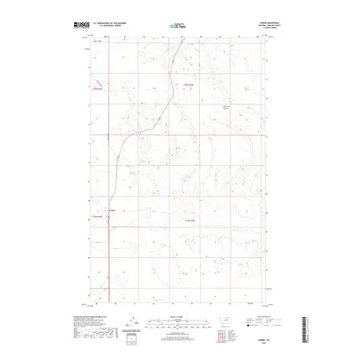
2020 Map of Loring
USGS Topo · Published 2020About this map
The settlement of Loring serves as the focal point for this 2020 Phillips County landscape, situated at the intersection of Main St and Sunnyslope Rd. This northern Montana region is characterized by its distinct drainage patterns, notably Lake Coulee in the northwest and Lone Tree Coulee to the east. The terrain is organized by the Public Land Survey System, with the map clearly delineating the boundaries of t36n r30e and t35n r30e. The map reflects the sparse, grid-based settlement typical of the high plains, where small clusters of infrastructure and water features are the primary landmarks across the wide-open prairie.
Find a feature on this map
9 named features on this map. Tap any name to fly to it.
Don’t see what you’re looking for? This feature index may not catch every label — zoom into the map to look around manually.
Map Details
Editions of this 2020 Loring Map
This is the sole edition of this map. No revisions or reprints were ever made.
Other maps of this area

1920 · Cowan
USGS Topo · 1:125,000

1954 · Glasgow
USGS Topo · 1:250,000

1957 · Glasgow
USGS Topo · 1:250,000

1958 · Glasgow
USGS Topo · 1:250,000

1968 · Austin Lake
USGS Topo · 1:24,000

1984 · Austin Coulee
USGS Topo · 1:24,000

1984 · Whitewater West
USGS Topo · 1:24,000

1984 · Morgan
USGS Topo · 1:24,000
1984 · Loring NW
USGS Topo · 1:24,000
1984 · Martin Lake
USGS Topo · 1:24,000