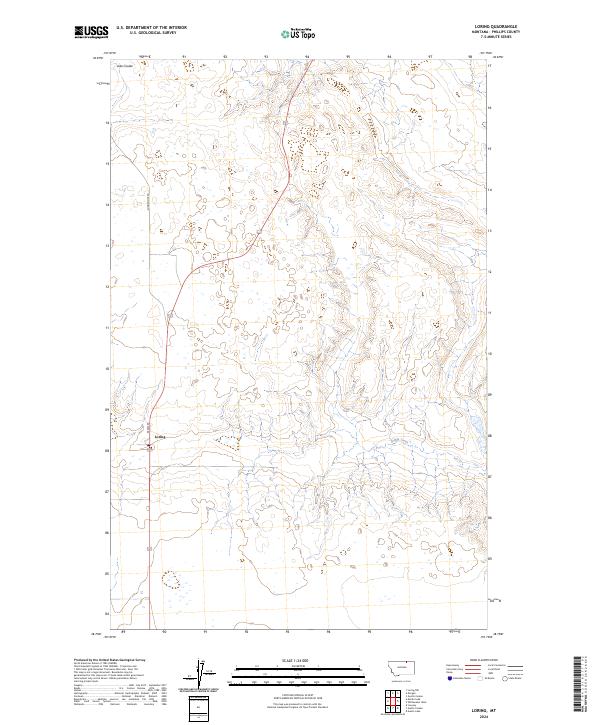
2024 Map of Loring
USGS Topo · Published 2024About this map
Loring sits at the junction of Main St and a primary highway in the northern reaches of Phillips County, Montana. This 2024 map documents the quiet agricultural landscape of the high plains just south of the Canadian border. The terrain is defined by the ephemeral water systems characteristic of the region, including the drainage of Dibble Creek and the seasonal depression of Lake Coulee. The rectilinear grid of the Public Land Survey System, including Township 36 North, Range 30 East, remains the dominant organizing principle for the network of local connectors like Sunnyslope Rd, illustrating the persistence of early homestead-era boundaries into the present day.
Find a feature on this map
9 named features on this map. Tap any name to fly to it.
Don’t see what you’re looking for? This feature index may not catch every label — zoom into the map to look around manually.
Map Details
Editions of this 2024 Loring Map
This is the sole edition of this map. No revisions or reprints were ever made.
Other maps of this area

1920 · Cowan
USGS Topo · 1:125,000

1954 · Glasgow
USGS Topo · 1:250,000

1957 · Glasgow
USGS Topo · 1:250,000

1958 · Glasgow
USGS Topo · 1:250,000

1968 · Austin Lake
USGS Topo · 1:24,000

1984 · Austin Coulee
USGS Topo · 1:24,000

1984 · Whitewater West
USGS Topo · 1:24,000

1984 · Morgan
USGS Topo · 1:24,000
1984 · Loring NW
USGS Topo · 1:24,000
1984 · Martin Lake
USGS Topo · 1:24,000