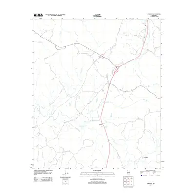
2012 Map of Lorman
USGS Topo · Published 2012About this map
Lorman and the surrounding rural communities of Jefferson County are captured here in a landscape defined by deeply carved creeks and a legacy of settlement along the old transit corridors. The modern Hwy 61 S bypasses the older routes, yet traces of the historic thoroughfares remain visible in Old Highway 61 and the winding Natchez Trace Pkwy that skirts the northern edge of the sheet. Smaller settlements like Coon Box, Melton, and Clifton cluster near the intersections of local farm-to-market roads, while the Russum Oil Field in the northeast indicates the ongoing importance of natural resource extraction in the region.
Find a feature on this map
44 named features on this map. Tap any name to fly to it.
Don’t see what you’re looking for? This feature index may not catch every label — zoom into the map to look around manually.
Map Details
Editions of this 2012 Lorman Map
This is the sole edition of this map. No revisions or reprints were ever made.
Other maps of this area

1909 · Lake Bruen
USGS Topo · 1:24,000

1939 · Lorman
USGS Topo · 1:62,500

1953 · Natchez
USGS Topo · 1:250,000

1956 · Natchez
USGS Topo · 1:250,000

1958 · St. Joseph
USGS Topo · 1:62,500

1959 · Natchez
USGS Topo · 1:250,000

1962 · Fayette
USGS Topo · 1:62,500

1963 · Port Gibson
USGS Topo · 1:24,000

1963 · Red Lick
USGS Topo · 1:24,000

1963 · Union Church
USGS Topo · 1:62,500