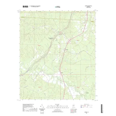
2020 Map of Lorman
USGS Topo · Published 2020About this map
Lorman stands as the primary settlement in this part of Jefferson County, situated along the corridor of Old Hwy 61. The landscape is defined by the winding route of the Natchez Trace Parkway and a dense network of watercourses, including North Fork Coles Creek and Shankstown Cr. For those researching local history, several small burial grounds are marked across the terrain, such as McCaa Cem, Waterloo Cem, and China Grove Cem, which often represent early family holdings or church sites. The map reveals a transition from the structured township lines to the irregular boundaries of older land grants. Small communities like Melton and Stonington punctuate the southern reaches, connected by named tracks like Poplar Hill Rd and Jessamine Ridge Rd, illustrating the persistent rural settlement pattern of southwest Mississippi.
Find a feature on this map
47 named features on this map. Tap any name to fly to it.
Don’t see what you’re looking for? This feature index may not catch every label — zoom into the map to look around manually.
Map Details
Editions of this 2020 Lorman Map
This is the sole edition of this map. No revisions or reprints were ever made.
Other maps of this area

1909 · Lake Bruen
USGS Topo · 1:24,000

1939 · Lorman
USGS Topo · 1:62,500

1953 · Natchez
USGS Topo · 1:250,000

1956 · Natchez
USGS Topo · 1:250,000

1958 · St. Joseph
USGS Topo · 1:62,500

1959 · Natchez
USGS Topo · 1:250,000

1962 · Fayette
USGS Topo · 1:62,500

1963 · Port Gibson
USGS Topo · 1:24,000

1963 · Red Lick
USGS Topo · 1:24,000

1963 · Union Church
USGS Topo · 1:62,500