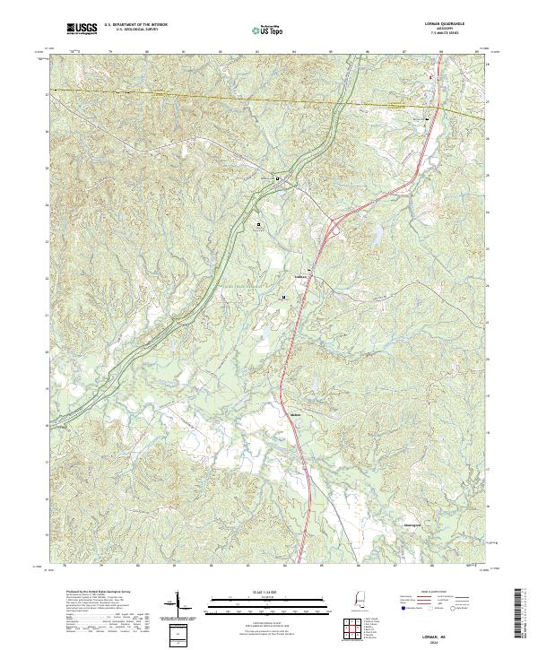
2024 Map of Lorman
USGS Topo · Published 2024About this map
Lorman and the surrounding woodlands of Jefferson County are defined by a complex network of tributaries feeding into North Fork Coles Creek. The modern Natchez Trace Parkway curves through the center of the sheet, shadowing the ancient path of travel that has oriented this region for centuries. The map reveals a landscape still rooted in its 19th-century settlement patterns, particularly evident in the scattered rural cemeteries like China Grove Cem and Waterloo Cem that anchor old family landholdings.
Find a feature on this map
49 named features on this map. Tap any name to fly to it.
Don’t see what you’re looking for? This feature index may not catch every label — zoom into the map to look around manually.
Map Details
Editions of this 2024 Lorman Map
This is the sole edition of this map. No revisions or reprints were ever made.
Other maps of this area

1909 · Lake Bruen
USGS Topo · 1:24,000

1939 · Lorman
USGS Topo · 1:62,500

1953 · Natchez
USGS Topo · 1:250,000

1956 · Natchez
USGS Topo · 1:250,000

1958 · St. Joseph
USGS Topo · 1:62,500

1959 · Natchez
USGS Topo · 1:250,000

1962 · Fayette
USGS Topo · 1:62,500

1963 · Port Gibson
USGS Topo · 1:24,000

1963 · Red Lick
USGS Topo · 1:24,000

1963 · Union Church
USGS Topo · 1:62,500