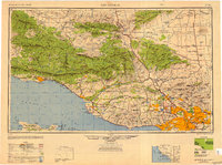
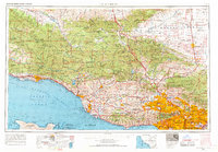
1949 Map of Los Angeles
USGS Topo · Published 1949This historical map portrays the area of Los Angeles in 1949, primarily covering Los Angeles as well as portions of Kern County, Ventura County, Santa Barbara County, and San Luis Obispo County. Featuring a scale of 1:250000, this map provides a highly detailed snapshot of the terrain, roads, buildings, counties, and historical landmarks in the Los Angeles region at the time. Published in 1949, it is one of 3 known editions of this map due to revisions or reprints.
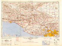
Map Details
Editions of this 1949 Los Angeles Map
3 editions found
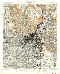
Historical Maps of Los Angeles Through Time
9 maps found
1928 Los Angeles
Los Angeles County, CA

1949 Los Angeles
Los Angeles County, CA
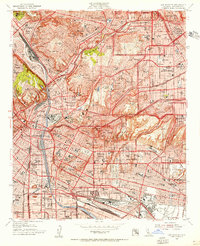
1953 Los Angeles
Los Angeles County, CA

1955 Los Angeles
Los Angeles County, CA
1959 Los Angeles
Los Angeles County, CA

1966 Los Angeles
Los Angeles County, CA
1966 Los Angeles
Los Angeles County, CA
1975 Los Angeles
Los Angeles County, CA

1979 Los Angeles
Los Angeles County, CA