
1959 Map of Los Angeles
USGS Topo · Published 1959About this map
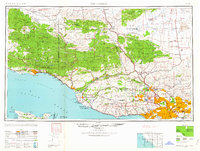
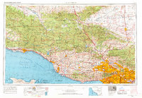
Los Padres National Forest and the Angeles National Forest dominate the high country on this mid-century survey, while the coastal plains show the rapid expansion of the Los Angeles metropolitan area. The transit network is a complex of major arteries including the Southern Pacific and Pacific Electric railroads, alongside a budding freeway system featuring U.S. 101 and U.S. 66. Along the coast, the Point Mugu Air Missile Test Ctr signifies the era's growing military and aerospace footprint. To the north, the Mojave Desert margin reveals an active mining landscape with the Double Eagle Mine and Cactus Mine near Rosamond. This map effectively documents the geographic transition between the agricultural heritage of the Cuyama Valley and the industrial urbanization spreading from Pasadena to Santa Monica.
Find a feature on this map
293 named features on this map. Tap any name to fly to it.
Don’t see what you’re looking for? This feature index may not catch every label — zoom into the map to look around manually.
Map Details
Editions of this 1959 Los Angeles Map
3 editions found
Other maps of this area

1894 · Los Angeles
USGS Topo · 1:62,500

1894 · Pomona
USGS Topo · 1:62,500

1896 · Pasadena
USGS Topo · 1:62,500

1896 · Anaheim
USGS Topo · 1:62,500

1896 · Redondo
USGS Topo · 1:62,500

1896 · Santa Monica
USGS Topo · 1:62,500

1896 · Downey
USGS Topo · 1:62,500

1897 · Pomona
USGS Topo · 1:62,500

1898 · Pomona
USGS Topo · 1:62,500

1898 · Santa Monica
USGS Topo · 1:62,500