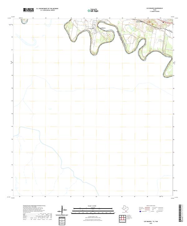
2022 Map of Los Ebanos
USGS Topo · Published 2022About this map
The Rio Grande snakes through the southern Texas borderlands, creating a series of dramatic oxbows that define the international boundary between the United States and Mexico. In the community of Los Ebanos, local streets such as Jose Garcia St and Julio Garza St lead toward the riverbank, where a small Post Office serves the area's residents. This landscape is shaped by the proximity of the water, with the terrain showing the scars of ancient river channels and sediment deposits.
Find a feature on this map
10 named features on this map. Tap any name to fly to it.
Don’t see what you’re looking for? This feature index may not catch every label — zoom into the map to look around manually.
Map Details
Editions of this 2022 Los Ebanos Map
This is the sole edition of this map. No revisions or reprints were ever made.
Other maps of this area

1940 · Monte Christo
USGS Topo · 1:62,500

1949 · Mc Allen
USGS Topo · 1:250,000

1954 · McAllen
USGS Topo · 1:250,000

1956 · Garcias
USGS Topo · 1:62,500

1956 · Los Ebanos
USGS Topo · 1:62,500

1957 · Mc Allen
USGS Topo · 1:250,000

1962 · McAllen
USGS Topo · 1:250,000

1963 · La Joya
USGS Topo · 1:24,000

1963 · Citrus City
USGS Topo · 1:24,000

1965 · La Grulla
USGS Topo · 1:24,000