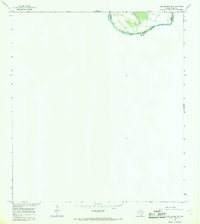
1965 Map of Los Ebanos NW
USGS Topo · Published 1968About this map
The Rio Grande defines the international boundary in this 1965 survey, documenting a dynamic section of the river where the United States and Mexico border remains subject to the water’s shifting course. A prominent feature on the northern bank is Valadeces Banco No 130, a topographic formation that illustrates the complex land management and boundary issues common in the river valley. The landscape is marked by several locations of a Well, indicating the critical role of groundwater for the remote outposts and ranching operations in this arid stretch of Texas and Tamaulipas. This map represents a moment when the International Boundary and Water Commission was actively monitoring river changes, noting that the boundary line was not completely defined at the time due to recent fluvial activity.
Find a feature on this map
5 named features on this map. Tap any name to fly to it.
Don’t see what you’re looking for? This feature index may not catch every label — zoom into the map to look around manually.
Map Details
Editions of this 1965 Los Ebanos NW Map
2 editions found
Other maps of this area

1949 · Mc Allen
USGS Topo · 1:250,000

1954 · McAllen
USGS Topo · 1:250,000

1956 · Garcias
USGS Topo · 1:62,500

1956 · Los Ebanos
USGS Topo · 1:62,500

1956 · Escobares
USGS Topo · 1:62,500

1957 · Mc Allen
USGS Topo · 1:250,000

1962 · McAllen
USGS Topo · 1:250,000

1965 · Rio Grande City South
USGS Topo · 1:24,000

1965 · La Grulla
USGS Topo · 1:24,000
1965 · Sullivan City
USGS Topo · 1:24,000