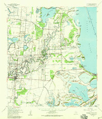
1956 Map of Los Fresnos
USGS Topo · Published 1959About this map
Palo Alto Battlefield anchors the southern landscape of this coastal Texas survey, marked by an Historical Monument and the Soldiers Cem. The terrain is defined by a complex network of resacas—ancient distributary channels of the Rio Grande—including Resaca de los Fresnos and Resaca de los Cuates. These winding waterways cut through a transition from agricultural ranchlands to the saline marshes of the Laguna Atascosa National Wildlife Refuge.
Find a feature on this map
74 named features on this map. Tap any name to fly to it.
Don’t see what you’re looking for? This feature index may not catch every label — zoom into the map to look around manually.
Map Details
Editions of this 1956 Los Fresnos Map
This is the sole edition of this map. No revisions or reprints were ever made.
Other maps of this area

1929 · Rio Hondo
USGS Topo · 1:24,000

1929 · La Coma
USGS Topo · 1:24,000

1929 · Palmito Hill
USGS Topo · 1:24,000

1929 · Point Isabel
USGS Topo · 1:24,000

1929 · Buena Vista
USGS Topo · 1:24,000

1929 · Laguna Vista
USGS Topo · 1:24,000

1930 · Padre Island No. 1
USGS Topo · 1:24,000

1930 · Los Fresnos
USGS Topo · 1:24,000

1930 · West Brownsville
USGS Topo · 1:24,000

1930 · Barreda
USGS Topo · 1:24,000