
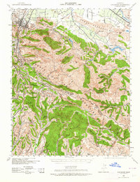
1940 Map of Los Gatos
USGS Topo · Published 1961About this map
Los Gatos serves as the gateway to the Santa Cruz Mountains in this 1940 War Department survey, where the transition from the Santa Clara Valley to high ridgelines is marked by small settlements and mountain retreats. The map documents the mid-century character of the region before modern suburban expansion, highlighting isolated institutions like Alma College and the unique community of Holy City. This era shows a landscape of scattered ranches and seasonal getaways, such as Lovely Glen Resort and Redwood Lodge, accessible via the winding roads and the Southern Pacific rail line.
Find a feature on this map
122 named features on this map. Tap any name to fly to it.
Don’t see what you’re looking for? This feature index may not catch every label — zoom into the map to look around manually.
Map Details
Editions of this 1940 Los Gatos Map
2 editions found
Other maps of this area

1889 · San Jose
USGS Topo · 1:62,500

1897 · San Jose
USGS Topo · 1:62,500

1897 · Mt. Hamilton
USGS Topo · 1:62,500

1897 · Palo Alto
USGS Topo · 1:62,500

1899 · San Jose
USGS Topo · 1:62,500

1899 · Palo Alto
USGS Topo · 1:62,500

1902 · Santa Cruz
USGS Topo · 1:125,000

1912 · Capitola
USGS Topo · 1:62,500

1914 · Capitola
USGS Topo · 1:62,500

1915 · San Juan Bautista
USGS Topo · 1:48,000