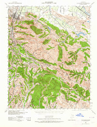
1940 Map of Los Gatos
USGS Topo · Published 1964About this map
The Santa Cruz Mountains and the Santa Clara Valley meet in this 1940 military edition survey, which captures the region before the post-war suburban transformation. The terrain is defined by prominent peaks like Mt Umunhum and Loma Prieta, the latter featuring a Loma Prieta Lookout. In the foothills, the map records the historic mining district at Almaden and Mine Hill, alongside various mountain communities such as Holy City, Alma, and Lexington. The presence of several reservoirs, including Calero Reservoir, Almaden Reservoir, and Guadalupe Reservoir, highlights the early water management infrastructure serving the agricultural valley below.
Find a feature on this map
121 named features on this map. Tap any name to fly to it.
Don’t see what you’re looking for? This feature index may not catch every label — zoom into the map to look around manually.
Map Details
Editions of this 1940 Los Gatos Map
2 editions found

Other maps of this area

1889 · San Jose
USGS Topo · 1:62,500

1897 · San Jose
USGS Topo · 1:62,500

1897 · Mt. Hamilton
USGS Topo · 1:62,500

1897 · Palo Alto
USGS Topo · 1:62,500

1899 · San Jose
USGS Topo · 1:62,500

1899 · Palo Alto
USGS Topo · 1:62,500

1902 · Santa Cruz
USGS Topo · 1:125,000

1912 · Capitola
USGS Topo · 1:62,500

1914 · Capitola
USGS Topo · 1:62,500

1915 · San Juan Bautista
USGS Topo · 1:48,000