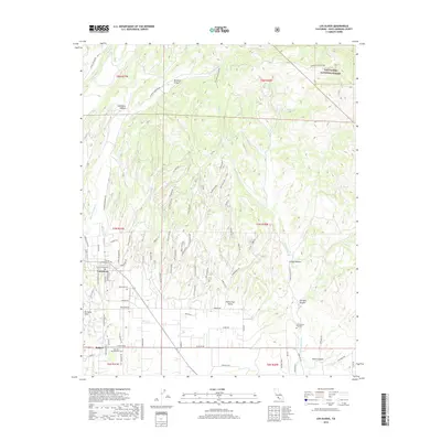
2018 Map of Los Olivos
USGS Topo · Published 2018About this map
Los Olivos and Ballard anchor the southwestern corner of this survey, where the Santa Ynez Valley meets the rising terrain of the Purisima Hills. The landscape is defined by a dense network of canyons and creeks, including Sycamore Canyon, Birabent Canyon, and Alamo Pintado Cr, which drain the southern reaches of the Los Padres National Forest. The transition from valley floor to steep ridges is marked by winding thoroughfares like Figueroa Mountain Rd and Foxen Canyon Rd, tracing routes through an area historically significant for its viticulture and ranching. Locally notable landmarks such as the San Lorenzo Seminary and Oak Hill Memorial Cem provide touchpoints for genealogists and local historians studying the Santa Barbara County interior.
Find a feature on this map
83 named features on this map. Tap any name to fly to it.
Don’t see what you’re looking for? This feature index may not catch every label — zoom into the map to look around manually.
Map Details
Editions of this 2018 Los Olivos Map
This is the sole edition of this map. No revisions or reprints were ever made.
Other maps of this area

1902 · Santa Ynez
USGS Topo · 1:125,000

1905 · Santa Ynez
USGS Topo · 1:125,000

1905 · Lompoc
USGS Topo · 1:125,000

1941 · San Rafael Mtn.
USGS Topo · 1:62,500

1941 · McPherson Peak
USGS Topo · 1:62,500

1942 · Lompoc
USGS Topo · 1:125,000

1942 · San Rafael Mtn.
USGS Topo · 1:62,500

1942 · Tepusquet Peak
USGS Topo · 1:62,500

1942 · Los Olivos
USGS Topo · 1:62,500

1943 · San Rafael Mtn.
USGS Topo · 1:62,500