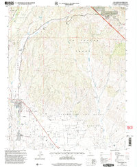
1995 Map of Los Olivos
USGS Topo · Published 2000About this map
The Santa Ynez Valley is revealed here as a landscape defined by its historic Spanish land grants and rural agricultural layout. The transition from the Los Padres National Forest in the northeast to the productive plains of the Rancho College Grant highlights the region's enduring ranching heritage. Local centers like Los Olivos and Ballard appear along the banks of Alamo Pintado Creek, preserving the mid-century character of these Santa Barbara County settlements.
Find a feature on this map
50 named features on this map. Tap any name to fly to it.
Don’t see what you’re looking for? This feature index may not catch every label — zoom into the map to look around manually.
Map Details
Editions of this 1995 Los Olivos Map
This is the sole edition of this map. No revisions or reprints were ever made.
Other maps of this area

1902 · Santa Ynez
USGS Topo · 1:125,000

1905 · Santa Ynez
USGS Topo · 1:125,000

1905 · Lompoc
USGS Topo · 1:125,000

1941 · San Rafael Mtn.
USGS Topo · 1:62,500

1941 · McPherson Peak
USGS Topo · 1:62,500

1942 · Lompoc
USGS Topo · 1:125,000

1942 · San Rafael Mtn.
USGS Topo · 1:62,500

1942 · Tepusquet Peak
USGS Topo · 1:62,500

1942 · Los Olivos
USGS Topo · 1:62,500

1943 · San Rafael Mtn.
USGS Topo · 1:62,500