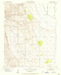
1954 Map of Los Viejos
USGS Topo · Published 1956About this map
Los Viejos Dome and the jagged topography of Las Colinas de los Caballetes dominate this mid-century portrait of Kings County. The landscape reflects a transition from the industrial infrastructure of the oil fields at Kettleman Station to the low, dry expanse of the Tulare Lake Bed to the east. Numerous arroyos, including Arroyo Robador and Arroyo del Pino, cut through the ridges of the North Dome, revealing a terrain defined by geological exploration and water management. Small outposts such as Los Medanos and El Bulto appear alongside various pipelines and gravel pits, marking the human footprint on these hills. The map captures a moment before modern irrigation and development fully transformed the edges of the lake bed, shown here punctuated by La Rambla Canal and the gridded survey lines of Utica Avenue.
Find a feature on this map
40 named features on this map. Tap any name to fly to it.
Don’t see what you’re looking for? This feature index may not catch every label — zoom into the map to look around manually.
Map Details
Editions of this 1954 Los Viejos Map
Other maps of this area

1912 · Coalinga
USGS Topo · 1:125,000

1914 · Lost Hills
USGS Topo · 1:125,000

1914 · Cholame
USGS Topo · 1:125,000

1915 · Cholame
USGS Topo · 1:125,000

1917 · Cholame
USGS Topo · 1:125,000

1930 · Discovery Well
USGS Topo · 1:31,680

1930 · Avenal Gap
USGS Topo · 1:31,680

1930 · Kettleman Plain
USGS Topo · 1:31,680

1930 · Middle Dome
USGS Topo · 1:31,680

1932 · Dudley Ridge
USGS Topo · 1:31,680