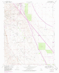
1954 Map of Los Viejos
USGS Topo · Published 1982About this map
The industrial and topographic development of the Kettleman Hills region is documented in this survey, showcasing a landscape defined by petroleum extraction and water management. Centered around Kettleman Station, the terrain is marked by numerous Oil Wells, an Oil Sump, and extensive pipe lines. The map reveals the Spanish-named topographic features that characterize the area, including the Los Viejos Hills, La Llanura, and Alturas Caballetes.
Find a feature on this map
44 named features on this map. Tap any name to fly to it.
Don’t see what you’re looking for? This feature index may not catch every label — zoom into the map to look around manually.
Map Details
Editions of this 1954 Los Viejos Map
Other maps of this area

1912 · Coalinga
USGS Topo · 1:125,000

1914 · Lost Hills
USGS Topo · 1:125,000

1914 · Cholame
USGS Topo · 1:125,000

1915 · Cholame
USGS Topo · 1:125,000

1917 · Cholame
USGS Topo · 1:125,000

1930 · Discovery Well
USGS Topo · 1:31,680

1930 · Avenal Gap
USGS Topo · 1:31,680

1930 · Kettleman Plain
USGS Topo · 1:31,680

1930 · Middle Dome
USGS Topo · 1:31,680

1932 · Dudley Ridge
USGS Topo · 1:31,680