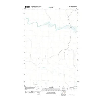
2011 Map of Lost Bridge
USGS Topo · Published 2011About this map
The Little Missouri River carves a winding path across this landscape, dominated by the notable crossing at Lost Bridge. The geography is defined by a sparse but structured network of section roads and drainage systems, including the long course of Corral Creek and the southern reaches of Frank Creek. This 2011 survey, centered near Mandaree, reflects the enduring rural character of the region, where the terrain dictates the positioning of essential infrastructure. Local travel is facilitated by a grid of numbered routes such as 104th Ave SW and 10th St NW, which bridge the gap between these significant watercourses and the higher plains.
Find a feature on this map
9 named features on this map. Tap any name to fly to it.
Don’t see what you’re looking for? This feature index may not catch every label — zoom into the map to look around manually.
Map Details
Editions of this 2011 Lost Bridge Map
This is the sole edition of this map. No revisions or reprints were ever made.
Other maps of this area

1953 · Watford City
USGS Topo · 1:250,000

1957 · Watford City
USGS Topo · 1:250,000

1958 · North Killdeer Mountain
USGS Topo · 1:24,000

1959 · Croff
USGS Topo · 1:24,000

1967 · Watford City
USGS Topo · 1:250,000

1970 · Mandaree
USGS Topo · 1:24,000

1970 · Lost Bridge
USGS Topo · 1:24,000

1970 · Figure 4 Ranch
USGS Topo · 1:24,000

1970 · Dunn Center NW
USGS Topo · 1:24,000

1970 · Mandaree SW
USGS Topo · 1:24,000